Rustler Gulch 
Distance: 6.4 - 10.0 miles (round trip)
Maroon Bells-Snowmass, Gunnison, near Crested Butte in Central Colorado
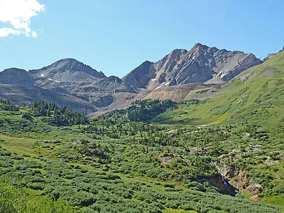
Cassi Peak and Peak 13,210
Hike through beautiful meadows to a lovely waterfall and high alpine basin beneath Precarious and Cassi Peaks. From mid-July to early August the meadows of Rustler Gulch host spectacular wildflowers displays.
See Trail Detail/Full Description
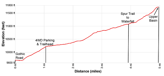
- Distance: 6.4 miles (round trip) to Waterfall
7.8 miles (round trip) to Upper Basin - Elevation: 10,240-ft. at Trailhead
11,100-ft. at Waterfall
11,740-ft. at Upper Basin - Elevation Gain: 860-ft. to Waterfall
1,500-ft. to Upper Basin - Difficulty: moderate
- More Hikes in:
Crested Butte / Central Colorado
Why Hike Rustler Gulch
Hike as far as you wish along this pretty trail ablaze with wildflowers during the height of the summer. The path ascends a beautiful valley traveling through spruce-fir forest and meadows along Rustler Creek. As you approach the head of the valley views open to lovely waterfall beneath the rugged cirque anchored by Precarious Peak (13,380-ft.) and Cassi Peak (13,232-ft.). A spur trail leading to the base of the falls is the destination for most parties.
A trail, which turns into a route, continues beyond the falls to the upper basin surrounded by massive talus fields spilling down the flanks of Precarious and Cassi Peaks. Here overlooks offers fine views of the Rustler Gulch valley and the cirque’s high peaks.
Note: A high clearance AWD/4WD is required to reach the trailhead. Hikers in passenger vehicles should park on the west side of the East River, wade the river and then walk 1.1 miles up the road to the trailhead. During periods of high water everyone should park before the river crossing and walk. Walking to the trailhead adds 2.2 miles round-trip and 560-ft. in elevation gain to the hike. A sign at the crossing warns of the number of cars damaged or totaled at the crossing.
Elevation Profile
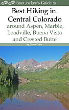
| Buy the BookThis opinionated guide includes all the hikes in the Aspen, Buena Vista, Crested Butte, Marble and Leadville sections of the website plus info on local services and nearby attractions. |
Trail Resources
Trail Detail/Full Description / Trail Photo Gallery / Trail Map
Basecamp(s) Information:
Crested Butte
Region Information:
Central Colorado
Other Hiking Regions in:
Colorado