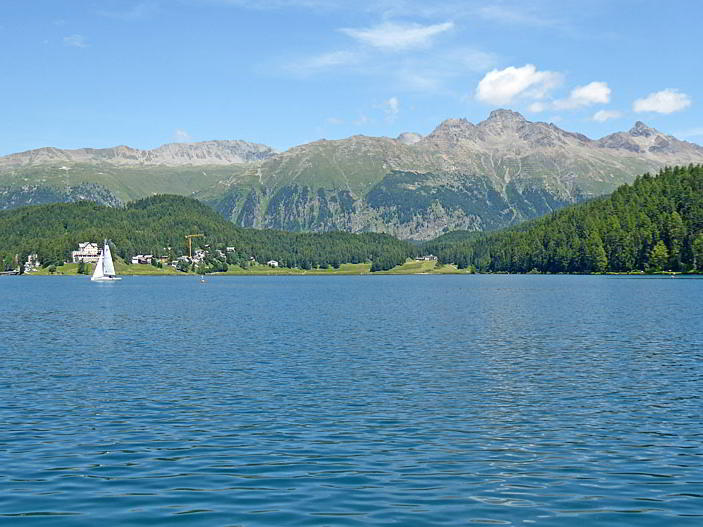
Summits rising above the Bernina Valley seen from Lake St. Moritz
The short, easy walk around Lake St. Moritz features fine views of St. Moritz and some of the high peaks rising above the Upper Engadine and Bernina Valleys.
- Distance: 2.8 miles (Loop)
- Elevation: 5,800-ft. at Trailhead
Maximum elevation - 5,850-ft. - Elevation Gain: 50-ft.
- Difficulty: easy
- Basecamp: St Moritz
- Region: Eastern Switzerland
Trail Description - Lake St. Moritz Loop
The hike around Lake St. Moritz can be started at the lake side exit of the train station or near the Catholic Church (Kath. Kirche) in St. Moritz Bad. (See directions to the trailhead below.) This description starts at the Catholic Church in St. Moritz Bad and walks in a counter-clockwise direction around the lake. The ease and views on the hike are not affected by the starting location or the direction you walk.
This walk is suitable for just about everyone and can be done at any time of the year. The paved and hard packed surfaces along the loop accommodate strollers and wheelchairs.
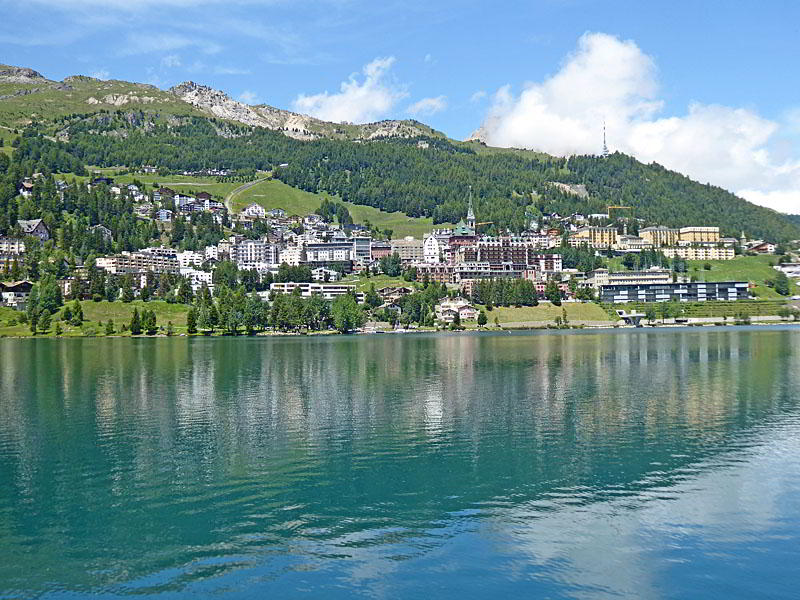
From the Catholic Church in St. Moritz Bad a short path quick leads to the lake’s south shore. Here views open north across the lake to St. Moritz, set amid the lower slopes of Piz Nair. Turn right (east/northeast) and follow the broad path beside the lakeshore as it passes a few apartment buildings in St. Moritz Bad and then travels along a wood hillside. Piz Padella rises to the north.
After hiking just under 1.0 mile (1.6 km) reach an intersection at the east end of the lake. To the right is a trail that ascends to Lej da Staz. A detour to pretty Lake Staz, set in a wooded bowl with fine view of the surrounding peaks, adds 1.8 miles (2.9 km) to the day.
Bear left at the intersection to continue the loop around Lake St, Moritz. From the eastern lakeshore enjoy nice views of Piz Nair, Piz Julier and Piz Albana rising to the southeast. At 1.2 miles (1.9 km) go by a second junction with the trail to Lej da Staz.
Past the second junction the path swings to the left, traveling around the north side of the lake. Piz Mezdi now dominates the view across the lake to the south. As you proceed along the north shore enjoy great views down the length of the lake (southwest) to Piz Julier, Piz Lagrev and Piz Margna. Ahead St. Moritz spills down the slopes beneath Piz Nair.
Soon the path crosses a paved bridge over the River Inn (En in Romansh), the outlet for Lake St. Moritz. On the other side of the bridge is a traffic circle. Before reaching the circle turn turn left to stay on the path around the lake. At 1.7 miles (2.7 km) a path branching right leads to the St. Moritz Bahnhof (train station), an alternative starting/ending point for the hike.
We now head west/southwest along the lake shore. To the east/southeast beautiful views open to Piz Muragl, Piz Languard and Piz Albris in the Bernina Valley. These views will evolve and improve as you approach to southwest end of the lake.
At 2.2 miles (3.5 km) pass the St. Moritz Sailing Club, which includes a restaurant, sailing school and boat rental facility. Beyond the sailing club is a small park.
At 2.5 miles (4.0 km) the path swings around the west side of the lake and soon crosses a bridge over the inlet stream before reaching the end of the loop at 2.8 miles (4.5 km).
Benches along the lakeshore offer plenty of places to stop and take a break, enjoy a snack or just soak in the sun on a nice day. Bathroom facilities can be found in the train station.
Elevation Profile

Driving Directions
From St. Moritz Bahnhof (Train Station): At the St. Moritz Train Station descend the stairs and follow the underground passage way to the north side of the lake. Signs will point to the Seerundweg (Lake Circuit). From other locations in St. Moritz, take the #6 or #9 bus to the St. Moritz Bad Catholic Church (St. Moritz Bad, Kath. Kirche) stop. Here paths lead to the lake’s western shore.
Get bus information from the local tourist office, visit the Engadine Bus Routes page, go to SBB website or download the SBB app to find the closest bus stop to your accommodations and the current schedule.
Trail Resources
- Trail Photo Gallery
- Trail Maps
- Basecamp(s) Information: St Moritz
- Region Information: Eastern Switzerland
- Other Hiking Regions in: Switzerland